Start from Kinsarvik: From the Esso Petrol station in Kinsarvik there is a small road going up in a western direction to Røte. There is a small wooden sign "Dronningstien" indicating the right road.
Park: After about 2.5 km, at the end of the paved road, it is possible to park at Røte (200 masl).
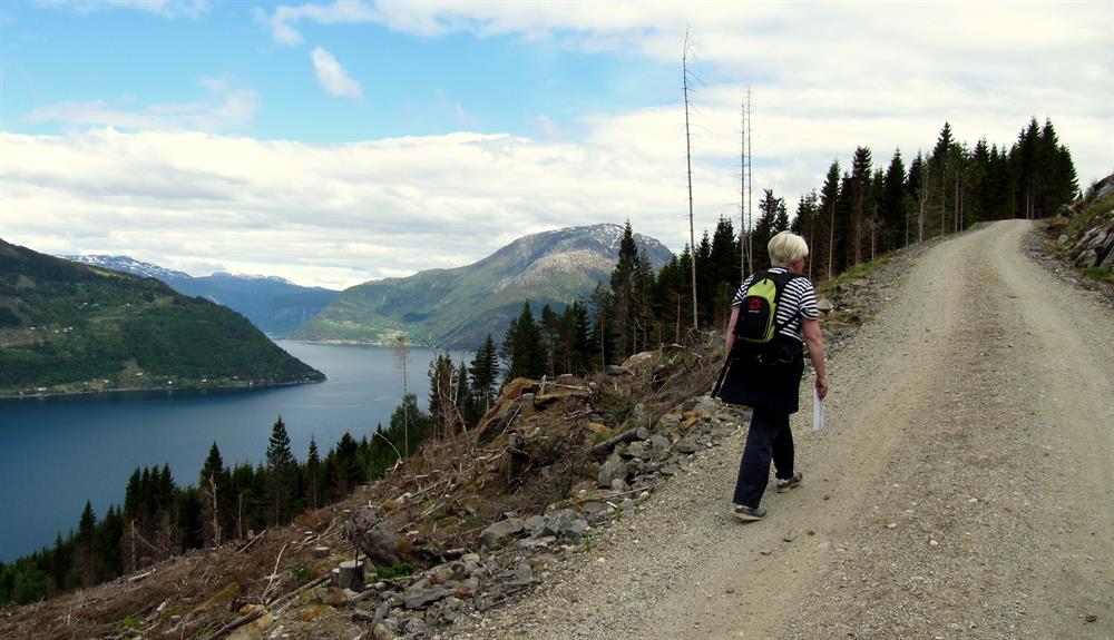
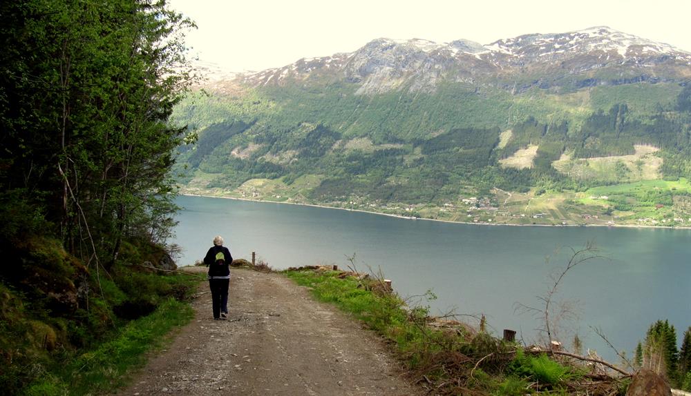
Start Røte: A dirt road goes from Røte up to Heng. The dirt road is private and not allowed to drive.
End: At Heng, about 750 masl.
By public transport: Bus from Odda, Eidfjord, Geilo, Voss stops in Kinsarvik. In the summer there is a boat stopping in Kinsarvk (to/fromNorheimsund with bus going to/from Bergen). Bus stop/Boat dock in Kinsarvik is about 2.5 km from Røte.
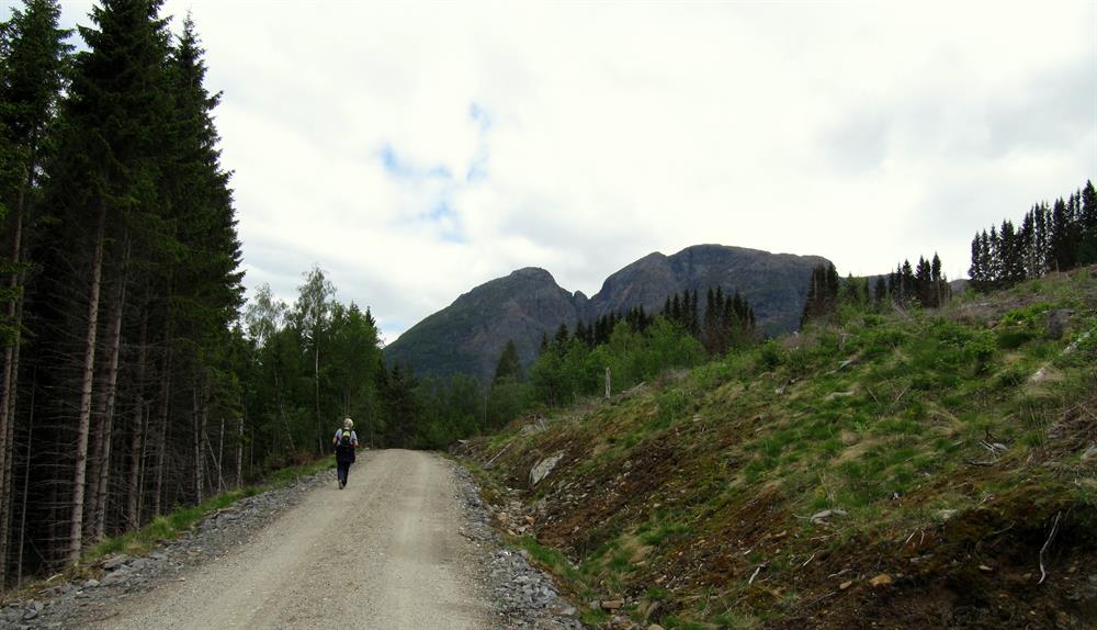
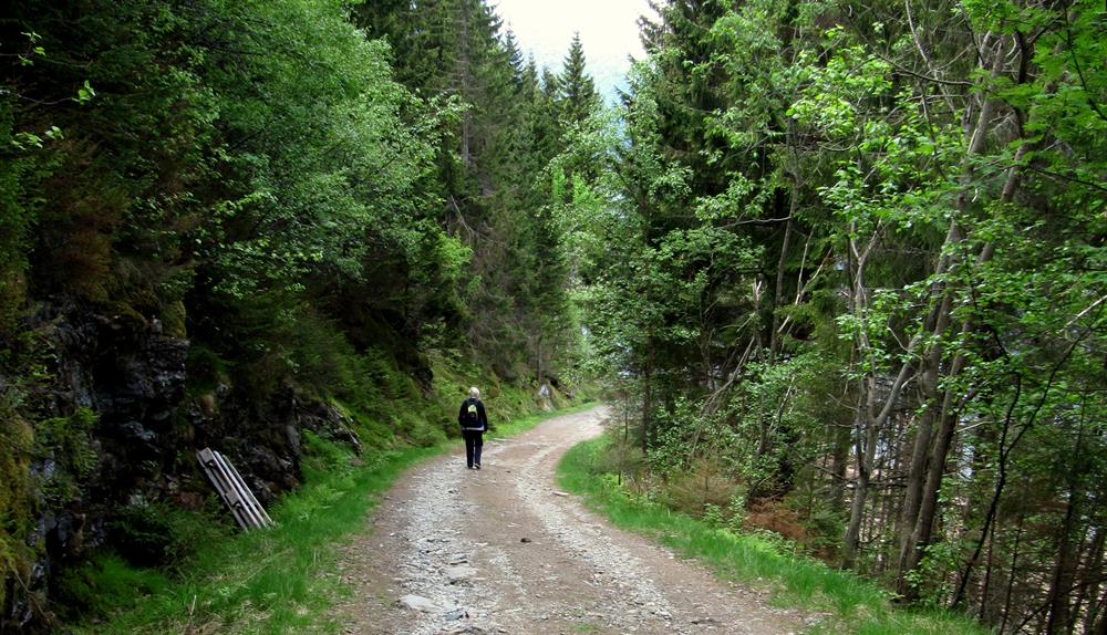
Grading: The dirt road is easy to walk in the beginning, but more uneven higher up. It is uphill all the way. The trail is intermediate in difficulty.
Length: Kinsarvik-Røte is about 2.5 km, Røte-Heng about 4.5 km.
Height differences: Height difference Kinsarvik-Røte is about 200 meters. Height difference Røte-Heng is about 550 meters.
Time: From the parking at Røte up to Heng it takes about 1.5-2 hours to walk.
Good advice: Wear good shoes, bring a snack and something to drink.
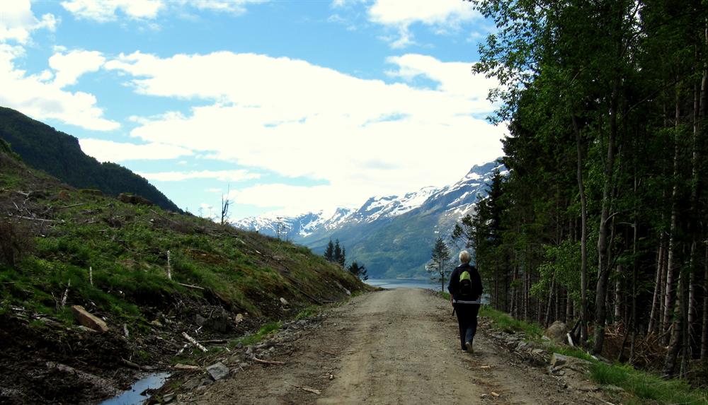
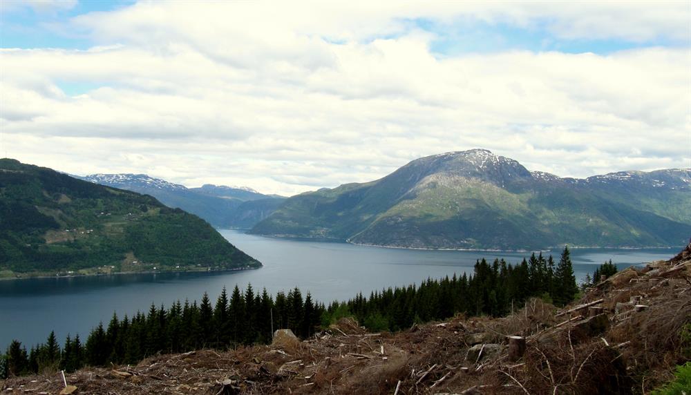
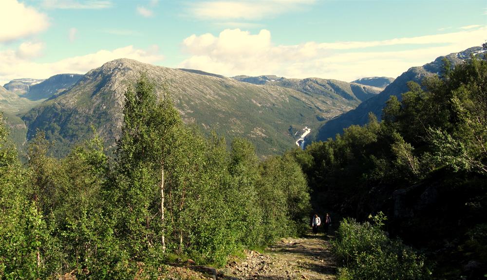
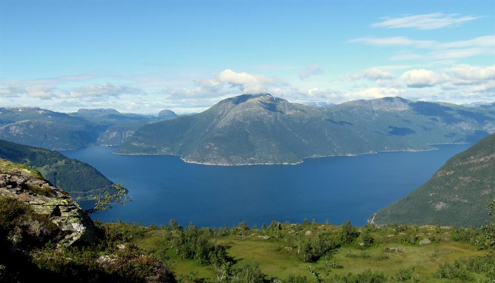
Description: Follow the dirt road from the parking at Røte up to Heng. The view to the Hardangerfjord improves as you go higher. From about 400 masl there is dense forest, and the fjord view is very limited until about 600 masl. The view from the top is very good.
Longer trails starting at Heng:
H M Queen Sonja's Panoramic Hiking Trail: It is possible to do the whole, or just a little, of the Queen's Trail, which starts at Heng. Wear warm clothes, good boots, bring nutritious food and drink, and a map and compass for the Queen's Trail. Season Queen's Trail: usually end June to mid-September.
Kongsberg Trail across Hardangervidda: The Kongsberg Trail is one of the old trade routes connecting east and west across Hardangervidda. With the opening of Kongsberg's silver mines, the town needed products like tallow. Herders drove livestock to the markets in the east. The Kongsberg Trail went from Kinsarvik up to Heng, and then across Hardangervidda. Today it is possible to follow this unmarked trail, using a map and compass. Wear warm clothes and hiking boots in Hardangervidda. Season Hardangervidda: July and August.