
Hike to Ulvanosa from Uskedalen
Location Uskedalen Overview Cross the bridge and follow the forest road to the left. After approx. 1 km, you will reach the lime station owned by Uskedalen Elveeigarlag (Uskedal River Proprietor Organization). Fr...
Contact information
About
Location
Uskedalen
Overview
Cross the bridge and follow the forest road to the left. After approx. 1 km, you will reach the lime station owned by Uskedalen Elveeigarlag (Uskedal River Proprietor Organization). From here, there is a path going up the Galtaryggen. This was previously a cattle road to bring the livestock to the mountain farm on Låganosa, 540m AMSL. In several places, you can see traces of left over stone stairs. On top of Låganosa, the terrain flattens and next to the stream there are some good places to put up a tent.
Some distance above Låganosa, the path divides and you may go either via Geitadalstind, or directly to Høgetind on the path under Geitadalstind.
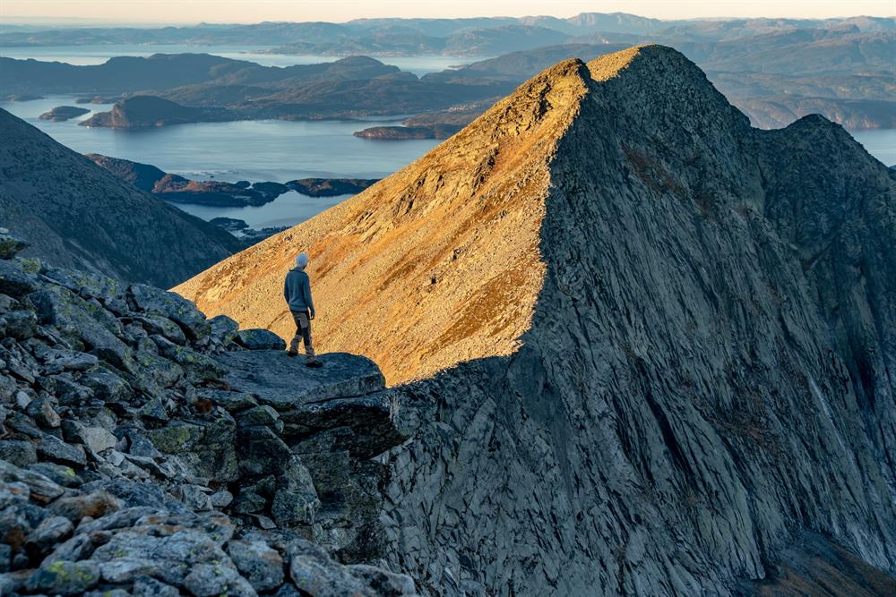
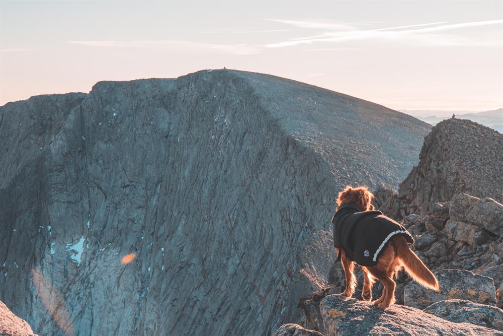
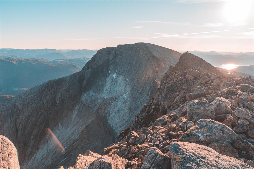
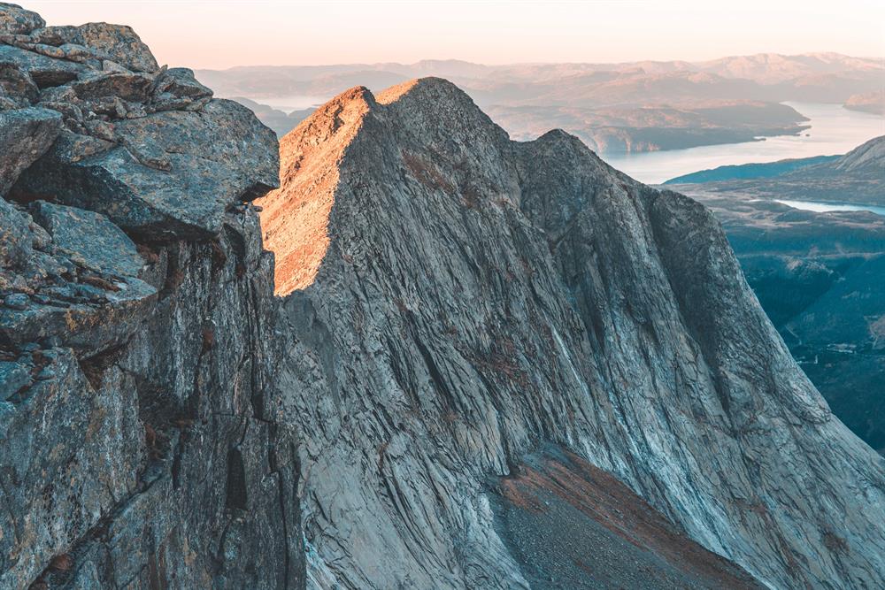
Geitadalstind is an alpine mountain top and is advised strongly against for those who do not like heights. The last part of the incline is steep and airy. Here, there is an alternative route to the right which is more shielded, also called Mini-Besseggen (Besseggen; famous mountain crest in central, southern Norway). From the top there is a magnificent view in all directions. You may enjoy the scenery from the glacier to the open ocean. Towards the north you can see the Bergen mountains, for example, Ulriken (Bergen’s tallest mountain). If you dare get close to the edge, the view can almost take your breath away. There is a very steep view down to the Musland farm, more than 1000 meters down. The steep mountain sides are popular climbing areas.
To get from Geitadalstind to Høgetind, follow the T Marked route approx. 100 meters down in the ravine between the tops. The estimated time from top to top is approx. 1 hour. Høgetind is 1248m AMSL and is the highest mountain in the area that is this close to the ocean, and like Geitadalstind, it has a marvelous view. The return to Uskedalen can be on a T Marked path under Geitadalstind.
Map
Folgefonna National Park
Start and stopping point
Upper Haugland, at the bridge that crosses the Uskedalselva river.
Parking
From highway 48, follow the sign and turn towards Musland.
After approx. 4 km, there is a parking lot by the bridge that crosses the Uskedalselva river to the right towards the forest road.
Marking
There are signs and an information board by the parking lot.
There are some T’s along the forest road. The path is T Marked from the lime station.
Grading
Black
Challenging hike, four boots according to the DNT system.
Difference in altitude
80 - 1248m MASL
Estimated Time
8 hours round trip
Recommended advice
When the snow is melted in late summer, it may not be possible to find water over 500m AMSL.
In the time periods when there is snow on Høgetind, be very careful about moving close to the edge. There may be snowdrifts hanging over the edge, that can collapse. From Høgetind you may follow the marked route down to Tveitedalen, Utåker directly. See separate description.